
SURAT — The Surat Municipal Corporation (SMC) has engaged a specialised consultancy to carry out comprehensive technical surveys of the creeks that overflowed and inundated parts of the city during the recent monsoon episodes, officials said on Monday.
Survey to include LiDAR, hydrology and drone mapping
The consultancy will undertake LiDAR mapping, hydrology studies and related assessments to produce detailed maps and data on creek channels, catchment areas and surrounding terrain. As an initial step, the firm will deploy drones to gather preliminary aerial information of the creeks and adjacent zones prior to full-scale fieldwork, the SMC said.
A state government–SMC committee formed after the floods reviewed the surveying plan at a meeting held at the SMC headquarters. The panel examined measures to prevent recurrent inundation and finalised an action plan for surveying and mapping creek systems to inform future flood-mitigation and drainage improvement projects.
Inter-agency data sharing ordered
Municipal Commissioner M. Nagrajan directed project directors from major infrastructure departments and key government bodies to submit details of utility services and infrastructure that pass through the catchment areas of the creeks within two days. The agencies asked to provide information include the National Highways Authority of India (NHAI), Dedicated Freight Corridor Corporation (DFCC), the Irrigation Department, and Gujarat Energy Transmission Corporation Limited (GETCO), among others.
Collector Tejas Parmar instructed the District Inspector of Land Records (DILR) to form a separate survey team immediately and provide maps and cadastral details to the surveying agency. The revenue department was also directed to expedite submission of records so that survey work is not delayed.
Officials said the surveying agency must coordinate with SMC to obtain necessary permissions from the Airports Authority of India, police department, Gujarat Maritime Board and other government bodies.
- Scope: LiDAR mapping, hydrology studies, drone surveys and catchment mapping.
- Coordination: SMC, state committee, DILR, revenue and multiple infrastructure agencies.
- Timeline pressure: Infrastructure details to be provided within two days to avoid delays.
Background and local impact
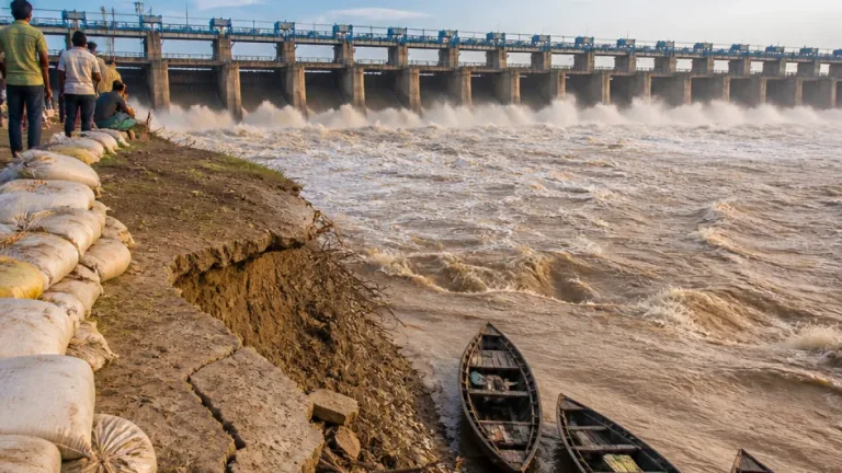
Surat suffered flooding twice within the last 20 days, with heavy downpours causing creeks to overflow and inundate low-lying areas, authorities said. The repeated incidents disrupted daily life and business activity in several neighbourhoods, underlining vulnerabilities in the city's drainage and creek-management systems.
Municipal officials told the committee that detailed surveying and mapping of the creeks and their catchment areas is essential for designing targeted interventions such as channel desilting, bank strengthening, relocation of vulnerable infrastructure, improved stormwater drains and more accurate flood forecasting. The technical investigations are expected to identify pinch points, obstructions and encroachments that exacerbate overflow during high rainfall.
| Agency | Role / Information required |
|---|---|
| NHAI | Details of highways passing through catchment areas |
| DFCC | Freight corridor infrastructure alignment and utilities |
| Irrigation Department | Water-control structures, embankments and flow data |
| GETCO | Transmission lines and substation locations in catchment zones |
| DILR / Revenue | Land maps, cadastral records and survey support |
Officials emphasised that timely sharing of data — including maps of utilities and infrastructure crossing creek catchments — is critical for the surveying agency to complete its work efficiently and to recommend practical remedial measures. The agency will also need permissions from the Airports Authority of India, local police and the Gujarat Maritime Board for certain operations.
SMC sources said the findings from the technical surveys will feed into a medium- to long-term creek management and flood-resilience programme, though officials did not provide a fixed timeline for completion of the consultancy's work or for implementation of subsequent mitigation measures.
With Surat's economy heavily reliant on industry and trade, repeated inundation has raised concerns among business owners and residents about infrastructure resilience. Authorities said the present exercise aims to produce an evidence-based plan to reduce the frequency and impact of future floods in creek‑affected localities.
Further announcements on the surveying schedule and public dissemination of the findings are expected after the initial drone and LiDAR reconnaissance is completed.