Multi-agency inspections map damage across Gangtok district
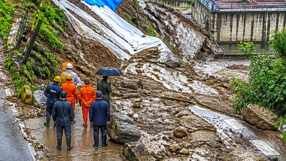
Gangtok — Heavy rainfall that lashed parts of Sikkim this week triggered landslides, mudflows and debris movements across several localities in the Gangtok district, prompting the District Disaster Management Authority (DDMA) to initiate an intensive damage assessment exercise.
Multi-agency teams began ground-level inspections on Wednesday and Thursday to identify hazard zones, clear obstructed stretches and determine immediate relief and restoration priorities. The inspection team was led by Kabi Tingda MLA Tshering T Bhutia and included DDMA officials, engineers from the Roads & Bridges Department, councillors, the Ranka Block Development Officer, revenue surveyors and other local functionaries.
Widespread impact on roads, homes and public infrastructure
Officials reported affected locations across a wide swathe of the district. Key areas where landslides, mud or debris accumulation were recorded include Bojoghari (Luing–Ranka Highway and Lower Bojoghari), Lingding, High Court Road, TNA Gate, VIP Colony, Upper Z–Bojoghari, the Pangthang–Lingdok Road, Pamro Gaon and Ling Perbing.
Other sectors surveyed were Upper and Middle Luing, Phenzong, Ranka, Rakdong Tintek, Daragaon, Upper Burtuk, Sichey and Arithang. Several road stretches remain obstructed, restricting vehicular movement, and some residential structures have been left vulnerable by slope instability and debris.
- Public utilities affected included the Sewage Treatment Plant at Sichey and debris accumulation near the Enchey School 33/11 kV Switching Station, identified as a potential hazard.
- Precautionary measures such as placing tarpaulins over vulnerable slide zones have been taken to reduce further rainwater seepage.
- Field teams continue to verify reported damages and prioritise clearance and assistance.
"Direct concerned line departments to clear roads and debris, restore connectivity,"
The District Collector, who also chairs the DDMA, has directed concerned line departments to clear roads and debris, restore connectivity, verify reported damages and extend assistance to affected residents. Teams of engineers and revenue surveyors are coordinating to record damage to public assets and private properties so that relief and repair can be prioritised.
Immediate response and next steps
As an immediate precaution, civil teams placed tarpaulins over vulnerable slide zones to prevent further seepage and limit additional slippage. Road crews and municipal workers have been tasked with removing debris and reopening blocked stretches, while revenue officials continue assessments of structural damage to residential houses.
Authorities said that the latest damage-mapping exercise is intended to help prioritise which roads and public utilities require urgent restoration, and to identify households needing immediate assistance. Field-level inspections are ongoing to refine the list of affected locations and to allocate departmental responsibilities.
| Issue | Reported locations |
|---|---|
| Road blockages / landslides | Bojoghari (Luing–Ranka Highway), Pangthang–Lingdok Road, Upper/Middle Luing |
| Damage to homes / vulnerable structures | Bojoghari, Lingding, High Court Road, VIP Colony, Arithang |
| Public infrastructure affected | Sewage Treatment Plant (Sichey), Enchey School switching station area |
Residents in low-lying and slope-adjacent localities have been urged to exercise extra caution as showers continue in parts of the state. The DDMA and line departments said they will finalise damage estimates after completing field verifications and will provide details of assistance measures thereafter.
This assessment follows continuing rainfall across the region and aims to provide a coordinated plan for clearance, repair and relief in Gangtok district.
Plain, verified reporting from the eastern Himalaya.