Rudraprayag, Uttarakhand — Continuous heavy rainfall has driven water levels in the Alaknanda River at Rudraprayag above the warning threshold, prompting the municipal administration to issue alerts and advise residents in vulnerable low-lying and riverside localities to move to safer areas.
Precautionary evacuations and local response
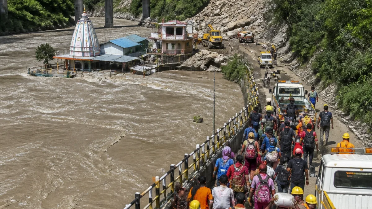
Officials from the Rudraprayag Municipal Council said teams have been making repeated public announcements across the town and deploying staff where required to assist those affected. Access to several houses along the riverbank has been disrupted as the swollen river submerged the Rudraprayag Sangam and nearby ghats.
“Due to continuous heavy rainfall across the entire region, rivers, drains and streams are in spate, causing water levels to rise steadily. We are advising residents in affected areas, including the entire municipal zone, to move to safer locations. Those living along riverbanks are urged to vacate their homes and relocate to safer areas,”
The comment was attributed to Santosh Rawat, chairperson of the Rudraprayag Municipal Council. Municipal officials said they were closely monitoring the situation and urging residents in susceptible zones to follow administrative advisories.
Impact on transport and pilgrimage
Authorities reported that continuous downpours had caused debris and boulders to fall on parts of the Kedarnath Highway. A landslide near Gaurikund deposited a large quantity of rocks roughly 200 metres before the Gaurikund Gate, completely obstructing the trekking route to the Kedarnath shrine.
As a precaution, the administration suspended the Kedarnath Yatra on July 30 and moved stranded pilgrims to safer locations. Officials said clearance operations were under way at blocked stretches of the road, and further announcements would be issued regarding resumption of the pilgrimage once conditions stabilise.
Local advisories and preparedness
Residents in low-lying wards and those living along riverbanks have been repeatedly told to remain vigilant and be ready to relocate if required. Municipal teams are conducting door-to-door advisories and setting up relief assistance where necessary.
To help residents assess immediate risks, authorities highlighted the following urgent measures:
- Relocate from ground-floor and riverside homes to higher ground.
- Keep essential documents, medicines and emergency kits ready for quick evacuation.
- Avoid crossing swollen streams or using submerged access routes.
- Follow official public announcements and directions from municipal teams.
Where river and road conditions worsened
Officials specifically flagged the Rudraprayag Sangam area and adjacent ghats as severely affected by the swollen river. Road movement on parts of the Kedarnath Highway was disrupted where debris fell, and clearance operations were being prioritised to restore connectivity.
| Location | Issue reported |
|---|---|
| Rudraprayag Sangam and ghats | Submerged access points, rising water levels |
| Near Gaurikund (≈200m before gate) | Landslide with large rocks/debris blocking trekking path |
Broader context
Rising river levels in the catchment follow sustained rainfall across the region, which has kept rivers, drains and streams in spate. The municipal council said monitoring would continue and further advisories would be issued as the situation evolved.
Residents and visitors in the district were urged to keep abreast of official bulletins and to cooperate with local authorities in evacuation or relief efforts. Those planning travel in the area, including pilgrims heading to Kedarnath, were advised to postpone journeys until the administration confirms that routes are safe for passage.
Further information and updates were expected from the Rudraprayag administration as clearance operations and monitoring proceed.
Reporting from the hills.